
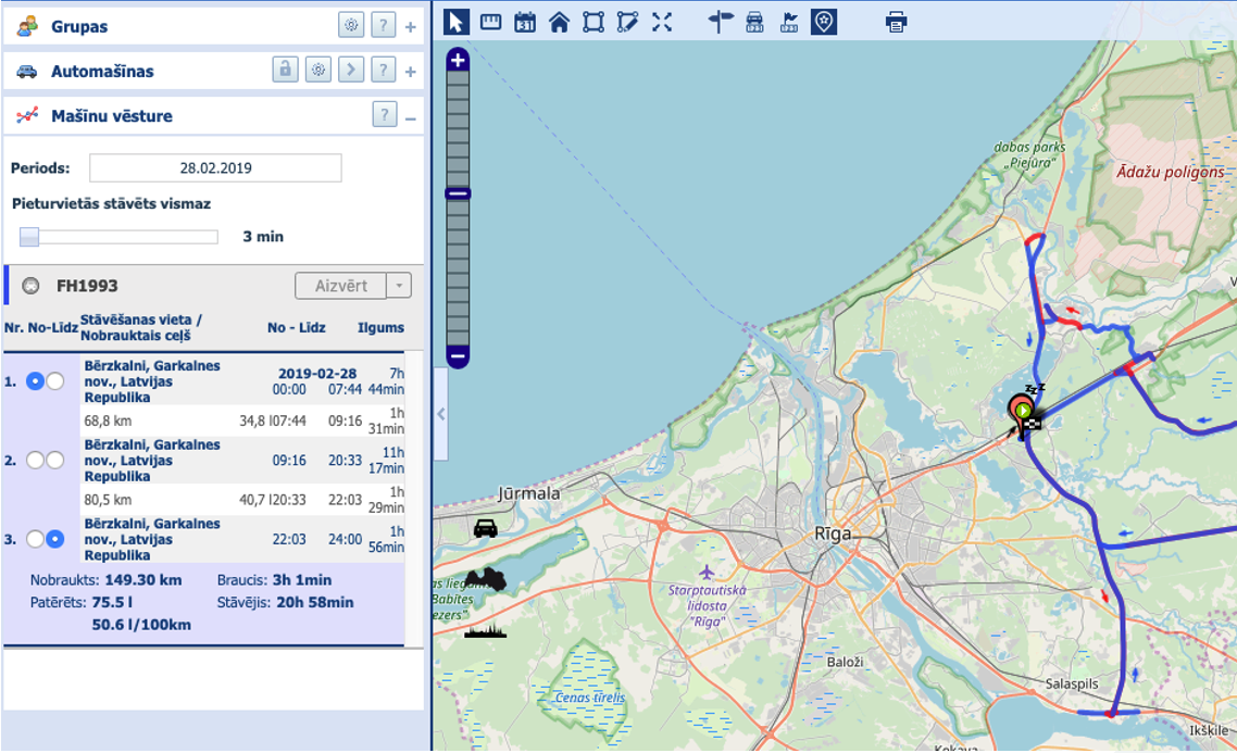
Riga Technical University (RTU) cooperation partner “Latvian Road Maintenance” (VAS “Latvijas autoceļu uzturētājs”), is constantly reviewing internal processes and looking for solutions for the effective use of resources. The priority is to automate manual work, although the road maintenance equipment is equipped with GPS receivers, until now it has not been possibleto automatically obain reports on the maintenance work performed on the road section – the time and materials consumed. The previously used fleet management system(see figure below) did not provide a clear picture of the road maintenance work carried out and required manual and time-consuming pre-processing of data. In the case of “Latvian Road Maintenance” 2017/2018. Almost 80,000 worksheets were created manually during the winter season.
The main challenges on reporting the work done report were:
- Potentially large number of machines and their simultaneous activity ( e.g. during a blizzard)
- The overlap of routes
- GPS and map layer inaccuracies, road section boundaries.
- Road section cleaning(in both directions) at intervals
- The cleaning of one road section with the help of several technical units
- The division of roads into sub-sections and correspoinding maintenance classes (A5, 2.4000-2.9100, Class A)
At the beginning of 2019, together with RTU, the work on developing an appropriate information system had started. Tasks which were defined in the project:
- Automatically determine the preliminary boundaries of road sections and their corresponding sub-sections.
- Riga bypass (Salaspils – Babīte) (A5) should be further divided into sub-sections: 0-2.4km, 2.4km- 2.9km, 2.9km – 34.57km.
- Provide functionality to the customer, which allows editing the boundaries of road sections and sub-sections.
- Import GPS data from the customers fleet management system and automatically group GPS points of the cleaning equipment route according to road sub-sections
- Possibility for the customer to adjust the affiliation of GPS points to the road sub-section cleaning
- Automatically identify the type of work corresponding to the sub-road cleaning
- The clearing of snow up to 6 metres wide with simultaneous wet salt spreading in the width of 5 metres , by spreading 40 grams/ m2
- The clearing of snow up to 7.5 metres in width with simultaneous wet salt spreading in the width 6 metres, by spreading 40 grams /m2
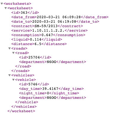
“Latvian Road Maintenance” ,(VAS “Latvijas autoceļu uzturētājs”), received the GPS data analysis systems for use in the 2019/2020 winter season of road maintenance and it the form of a pilot project, it was introduced in the Ķeipene and Limbāži regions in order to record maintenance works on the state roads.The created system is based on open spatial data and open source solutions and provides maintenance of GPS data if maintenance equipment form the fleet management system, data pre-processing and automated creation of worksheets corresponding to active road maintenance contracts( an example of an automatically created worksheet is attached down below).
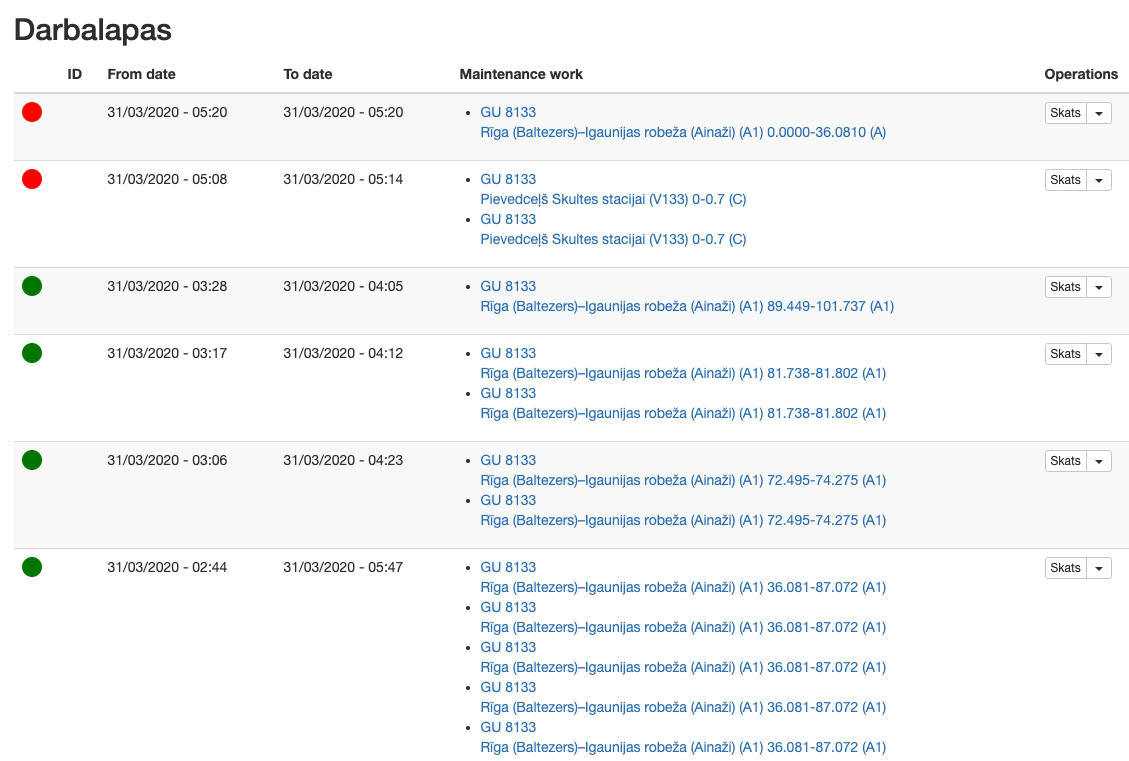
In the case of inaccuracies of the “Latvian Road Maintenance” employees, the created worksheets are corrected and its comappnies work accounting system is made public(see picture down below).
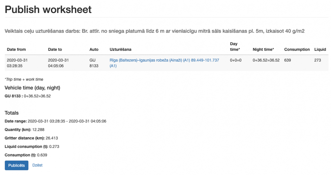
The published worksheets are exported in XML format to the companies work tracking system( see image down below).
The time saved from the reports and easy-to-use graphical report have allowed to focus more on improving the efficiency of other road maintenance processes.
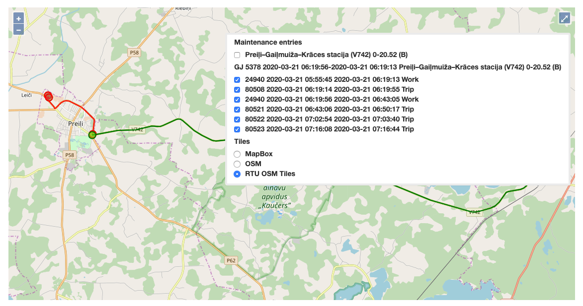
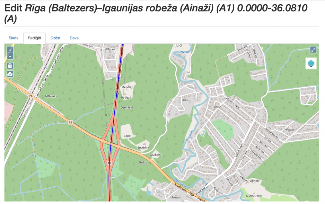
At the end of the winter road maintenance season, the work continues on improving the accuracy of the system with the help of machine learning models and improving spatial data to start in 2020/2021. The GPS data analysis system could be made available to all “Latvian Road Maintenance” ,(VAS “Latvijas autoceļu uzturētājs”),units for the winter road maintenance season. The staff of “Latvian Road Maintenance” can be involved in improving the quality of the spatial data layer using the spatial data editor integrated in the browser (see image down below).
In the future, the system is intended to be used for urban districts and for recording other maintenance work ( e.g. grading).
Technologies used
The system is based on open source technologies and open data:
- OpenStreetMap and Latvijas Valsts ceļi spatial data,
- Drupal 8 and Symfony 3 ietvars,
- PostgreSQL database with PostGIS, pgRouting extension,
- Mapnik map server,
- OpenLayers dynamic maps,
- Python, scikit-learn,
- Integration with HansaWorld and SkyFMS.